Adapting to the Climate Crisis
Washington’s water supply is already under stress from overuse—the climate crisis will only exacerbate this problem—unless we modernize our water management to build resilience.
")
 Impacts of Climate Change Infographic(2)")
How the Climate Crisis Will Change the Flow of Water in Washington
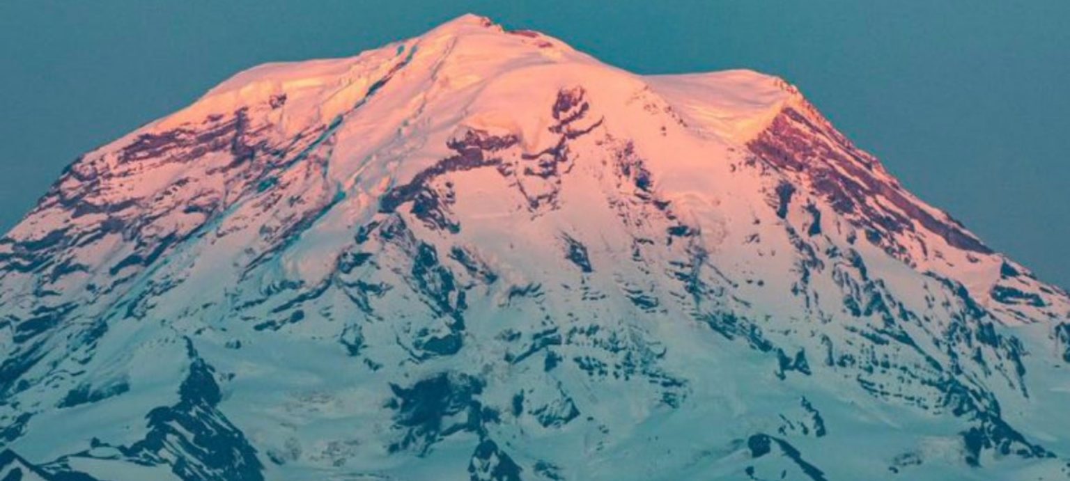
Snowpack
With our impressive mountain ranges, the hydrology of the PNW is particularly sensitive to changes in climate because seasonal runoff is dominated by snowmelt from cool season mountain snowpack. With the Cascade Mountains, Washington is partitioned into two distinct climatic regimes with the wetter west side and drier east side. With over 75% of the annual precipitation in the Cascades falling during the cool season (October through March), the resulting snowpack is relied upon to sustain warm season (April through September) streamflows. Even the slightest temperature changes have a significant impact on the balance of precipitation falling as rain or snow.
As snow accumulates in upper elevations and forms a “natural reservoir” that stores water during times when demands are relatively low. As the climate has warmed due to the burning of fossil fuels, more precipitation in Washington’s mountain ranges falls as rain and less as snow, leaving less water naturally stored in snowpack and glaciers. Furthermore, we’re observing snow melts occur more rapidly—with peak runoffs taking place one to four weeks earlier than in the 1950s—and so less water is available to feed streams in the late summer when water demands are highest.
These patterns are expected to continue and further alter the hydrologic behavior of many watersheds in Washington. Under a moderate emissions modeling scenario, spring snowpack levels across the state are projected to decrease 29 percent by the 2020s, 44 percent by the 2040s, and 65 percent by the 2080s, relative to the 1971-2000 average.
While impacts will be felt throughout the state, depending on the type of basin, those impacts may look a little different:
- The Columbia River is snow-dominated basin; as temperatures increase we are likely to see reduced peak spring streamflow, increased winter streamflow, and reduced late summer flow
- The Yakima River is a mixed rain-and-snow dominated basin; as temperatures increase it will likely shift to a rain-dominated basin type. Peak streamflow will occur earlier in the spring with late summer streamflows declining.
- The Chehalis River is a rain-dominated basin in which increasing temperatures are unlikely to chnage streamflow timing. However, the basin will likely experience higher winter streamflow due to the potential for more winter precipitation.

Water Temperatures
Think for a moment about wading into a lake on a warm summer day. When the water is only high enough to reach your ankles, it likely feels quite warm, but as you step out and the water rises to your chest it becomes much cooler. Now imagine you’re a salmon who has spent the past few years living out in the Pacific where upwelling keeps the water around a crisp 50°F with plenty of dissolved oxygen. Living in the nutrient rich ocean has made you healthy and strong. Its time to head back to the place of your birth to spawn—a journey that requires you to swim from the ocean hundreds or thousands of miles upstream—when you suddenly find yourself in much warmer water with little time to adjust. All of a sudden, your metabolism has kicked into overdrive. You find yourself needing more oxygen, but you can’t get enough in the shallow stream that is far too warm. An already incredible physical feat has just become impossible; unable to “catch your breath”, you die.

Unfortunately, this is the fate of our salmon if we don’t act quickly and decisively to slow climate change. While declining salmon returns are the result of a broad suite of factors, increasing river and stream temperatures are a direct result of a warming climate. Warmer air temperatures and less input of cool water from snowmelt is resulting in warmer water temperatures. Average stream temperatures in Washington are projected to warm by between 3.6 and 10.5 degress Fahrenheit by the end of the century. Scientists estimate that 1,016 Puget Sound river miles will exceed 64 degrees Fahrenheit for up to 7.5 weeks. While 64°F may sound comfortably cool to you as a human, for salmon, that is the temperature at which they start to experience heat stress. And if they encounter water 70°F and above, they begin to die.

Drought + Wildfires
The entirety of the West is currently in the midst of a 20+ year megadrought that is unlikely to end anytime soon. A recent study analyzing tree rings has determined the drought that started in 2000 is now the driest two decades in over 1,200 years. Its yet another example of the data clearly indicating how unusual current conditions are. The study also confirms the role of temperature, more than precipitation, in driving exceptional droughts. Precipitation amounts can vary over time and by region, but as humans continue to pump greenhouse gasses into the atmosphere, temperatures most everywhere are consistently rising. Drier and warmer, the air is essentially more capable of pulling water out of our ecosystems—from natural reservoirs of moisture such as soil and plants—it makes for drought conditions to be much more extreme than if climate change wasn’t a factor.
By 2050, the severity of widespread summer drought is in Washington state is projected to quadruple. Among all US states, Washington is expected to suffer the single greatest increase—both in percentage terms and in terms of absolute change—far above average for both. Just as drought threat varies from state to state, the impacts of climate change on drought conditions within Washington will vary from county to county. The Yakima Basin in particular is incredibly vulnerable to drought.
Water from the Yakima Basin supports a broad suite of municipal, agricultural, tribal, recreational, and environmental uses. However, water right curtailments across irrigation districts have had to been put in place during every severe drought on record since the 1970s; projected situations under future climate change scenarios will only increase water scarcity and competition. Historically, curtailments have occurred on average once every seven years, but models indicate curtailment could increase to once every three years in the 2040’s and three of every four years by 2080.
The inability of the reservoir system to supply water to all users will translate to a decline in apple and cherry production of $23 million by the end of the 2020s and $70 million by 2080. Drinking water supplies for small rural communities, forest productivity, hydropower production, and river navigability for both recreational users and migrating salmon are all also at risk of experiencing severe adverse effects as a result of longer, deeper summer droughts.
Wildfires are a natural part of most forest ecosystems , but due to climate change, they have become larger, more severe, and damaging as opposed to spurring renewal. Throughout Washington state, warmer temperatures and drought conditions have already led to an increase in the instance and severity of wildfires; the Western US as a whole has experienced twice as many large fires between 1984 and 2015. Under future climate change predictions, each 1C rise in temperature will correlate to a 600% increase in the area burned during a typical year. Wildfires disrupt critical watershed processes leading to erosion, warmer water temperatures, increased water pollution from stormwater runoff, and loss of forest canopy altering an ecosystem’s capacity to retain water and recharge aquifers.